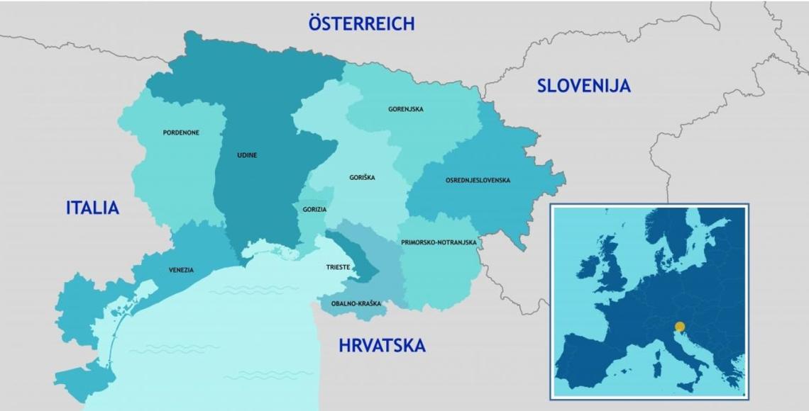
The Interreg VI-A Programma Area extends over a total surface of 19,841 km2 and has a total population of approximately 3 million inhabitants.
The Programme area covers 10 NUTS 3 territorial regions, 5 of which in Italy (Venice, Udine, Pordenone, Gorizia and Trieste) and 5 in Slovenia (Primorsko-notranjska, Osrednjeslovenska, Gorenjska, Obalno-kraška and Goriška).
Overall, on NUTS 2 level, the Programme Area covers the 2 Italian regions Veneto and Friuli Venezia Giulia, and the 2 Slovenian regions Slovene Western and Eastern Cohesion. The five Italian NUTS 3 regions are one in NUTS 2 region Veneto and four in NUTS 2 region Friuli Venezia Giulia and the five NUTS 3 regions on the Slovenian side are one in NUTS 2 cohesion region Vzhodna Slovenija and four in NUTS 2 cohesion region Zahodna Slovenija.
The cooperation area embraces various spatial development models. A particular example is represented by the functional area between the municipalities of Gorizia (IT), Nova Gorica and Šempeter-Vrtojba (SLO), where a European Grouping of Territorial Cooperation (EGTC) - the most advanced form of cross-border territorial cooperation at European level - has been operating since 2011. The EGTC shares goals relating to common modernization and innovation in the fields of environment, infrastructure, urban transport, logistics, energy and economic development; moreover, the title of the European City of Culture 2025 Nova Gorica-Gorizia has a strategic importance for the Programme Area since it represents a driving force for development.
The Programme area, which is highly heterogeneous in geographical terms, includes coastal areas, mountain ranges, rural and urban areas (Trieste, Udine, Gorizia, Nova Gorica, Ljubljana, Pordenone, Venice, conurbations Koper-Island-Pirano and Kranj-Postojna) and lagoon areas.
Below is a map of the Programme area.