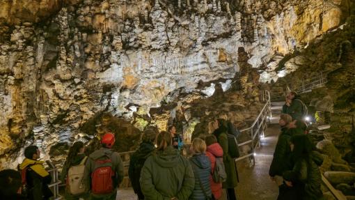
Karst landscapes and underground features are popular for tourism and recreational activities due to their unique characteristics and year-round accessibility. However, in certain locations within the future transborder geopark Kras-Carso (e.g., karst caves and protected areas), this popularity can lead to increased pressure on the natural environment. To preserve nature and natural heritage, it is essential to determine the so-called carrying capacity of nature, which defines the upper limit of acceptable impacts from various activities that can occur at a given location without causing negative effects on the environment and landscape of the Karst.
As part of the KRAS-CARSO II project, co-financed by the European Union under the Interreg VI-A Italy–Slovenia Programme, the Institute of the Republic of Slovenia for Nature Conservation, in collaboration with project partners, prepared two expert studies focused on nature conservation and sustainable tourism development in the future cross-border geopark Kras-Carso.
The first study, titled Assessment of the State of Protected Natural Areas and Tourism Use, highlights the areas within the geopark most burdened by tourism, hiking, cycling, climbing, horseback riding, and caving. The results show that the most impacted areas include the karst edge between Duino/Devin and Opicina/Opčine, Lipica, the Škocjan Caves Regional Park, Vremščica, Slavnik, and the Val Rosandra/Glinščica Valley. These areas may require future measures to reduce negative environmental impacts, such as visitor regulation, restricted access, increased awareness, and more. The study also provides guidelines for geopark visitors and managers of specific sites within the geopark.
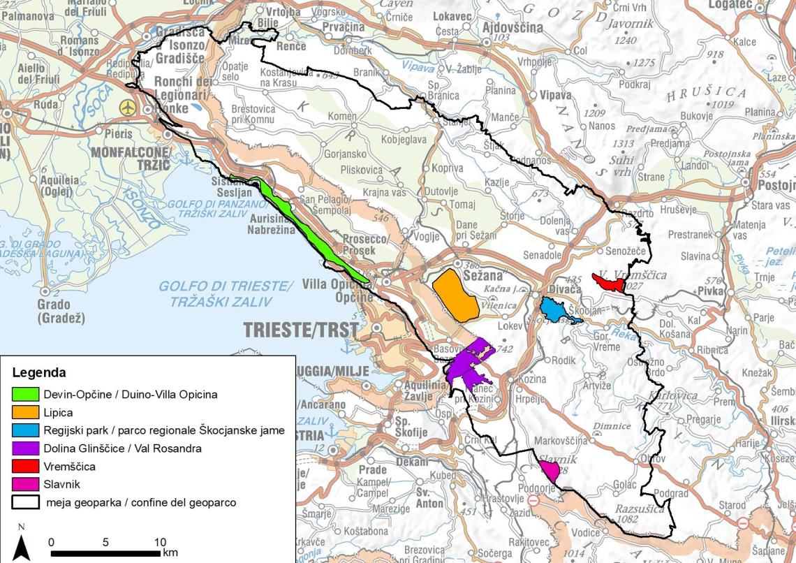
Figure 1: Areas in the geopark most affected by tourism and recreational activities.
The second study, Carrying Capacity of Nature for Selected Geolocations, is based on assessments of the natural state and includes carrying capacity calculations for seven selected locations in the geopark. These include five tourist caves; Dimnice, Pečinka, Krompirjeva jama, Divaška jama, and Grotta Gigante/Briškovska jama, and two protected areas; the Val Rosandra/Glinščica Valley (including the Beka Landscape Park and the Val Rosandra Nature Reserve) and the Duino Cliffs Nature Reserve. The carrying capacity defines the maximum number of people that can be present at a location (in a cave or protected area) without causing negative impacts on nature, natural and cultural heritage, the environment, and the Karst landscape. Ensuring a high-quality nature experience for visitors is also important. The calculations consider physical limitations (e.g., space dimensions, access time), environmental and weather factors, conservation needs (e.g., rest periods for nature), safety (e.g., trail erosion, walking difficulty), and social factors (e.g., group size, spacing). Existing management capacities such as infrastructure, parking, sanitation, and the number of trained guides is also considered. The key task for site managers is sustainable management to prevent visitor numbers from exceeding the carrying capacity. The data obtained is primarily intended as a tool for managers to help with visitor organization and infrastructure planning. If the carrying capacity is approached or exceeded, key measures include limiting visitor numbers, reducing pollution impacts, and more. In protected areas, it is crucial to monitor the state of nature and heritage, management adequacy, infrastructure, and local community needs. The study also provides guidelines for managing and sustainably using tourist caves and protected areas, aimed at caving and tourism associations, municipalities, site managers, visitors, and other stakeholders who directly or indirectly influence the carrying capacity of these locations.
Figure 2: Locations in the geopark selected for carrying capacity calculations.
These studies provide a professional foundation for the sustainable management of the cross-border geopark Kras-Carso and its sites. They also significantly contribute to improving sustainable tourism development and the conservation of geodiversity and biodiversity in the Karst region.
Text: Jana Preradovič in Martina Stupar, ZRSVN
Photos: J. Preradovič