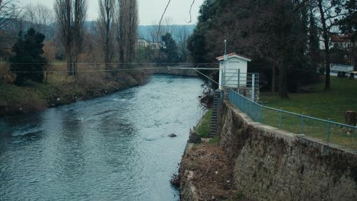
Starting from February 10th and lasting for about a week, the partners OGS, University of Ljubljana, and Polo Tecnologico Alto Adriatico carried out a significant data acquisition campaign at the Vipava test site. The objective was to collect essential geophysical, geological, and hydrological information for characterizing the hydrogeological basin and monitoring the water resource.
During this phase, a kind of "ultrasound scan" of the ground was performed—an advanced technique that allowed researchers to investigate the depth at which the limestone rock is located, which emerges at the surface toward the mountains. This methodology made it possible to visualize how the rock extends in depth and determine its exact position, providing essential data on the thickness of the sediments that may contain water. These insights are crucial for understanding the recharge mechanisms of aquifers and the path the water takes before flowing into the Vipava River and, subsequently, into the Soča River.
At the same time, a geoelectric survey was conducted, another subsurface exploration technique based on measuring the electrical conductivity of the ground. This method involved inserting small iron electrodes into the ground at predetermined distances and applying an electric current to observe how it propagates underground. By analyzing the electrical response of the soil, it was possible to outline the arrangement of geological layers and obtain a detailed representation of the underground structure.
These data, integrated into the cross-border database, will contribute to the development of the conceptual hydrogeological model and water balance scenario, essential tools for improving the management and protection of water resources in the cross-border area between Italy and Slovenia. Within the framework of the WABIN project, this information will be used to refine water monitoring and management methodologies, ensuring a more sustainable and climate-resilient approach.

