IN4SAFETY
Specific objective: SO 4 - Promoting climate change adaptation and disaster risk prevention, resilience, taking into account eco-system based approaches
Typology: capitalisation project
The common challenge addressed by IN4SAFETY was to build cooperation for disaster risk prevention and climate change risk reduction, which dictated the need for a more coordinated response to natural disasters in the programme area. The vulnerability of the area and the need for cooperation were particularly demonstrated by the fires in the cross-border area of the Karst in the summer of 2022.
- The overall objective of the project was to promote resilience capacities to climate change and the prevention of risks related to natural disasters by strengthening cross-border cooperation between local authorities and rescue teams through the development of 2 action plans, the integration of territorial data and joint training of rescue teams.
- The innovation of the project lay in the establishment of a helicopter emergency plan, which complemented the already established crossborder cooperation with a cross-border airborne intervention system for faster and more efficient rescue operations, and the complementation of the territorial platforms with electronic data on the terrain and high obstacles needed for airborne rescue.
The main direct output of the project was joint emergency action plans in the cross-border area, and the results were improved capacities for climate resilience and natural disaster risk prevention, benefiting governance authorities at all levels, civil protection and emergency responders, research and education institutions, and the local community.
OU 1.1 Joint Action Plans for Emergency Response in the Cross-Border Area
The project contributed to the output and indicator with two action plans that ensure an appropriate response to emergencies in the cross-border area.
The D 1.2.2 HEMS Action plan allows for the crossing of national borders during aerial operations and will be drafted in collaboration with partners from the FVG and Veneto regions.
The D 1.2.1 Emergency Response Plan for the CMVe area was drafted in collaboration with the FVG region and includes guidelines for cooperation across the entire area.
Open The Emergency Response Plan for the CMVe
OU 2.1 Joint Training Plan
We have prepared a joint training plan that has helped improve the readiness of rescue units, thereby strengthening cooperation capabilities in the program area. The plan included a program of exercises for conducting responses to cross-border emergencies, a glossary of common phrases for the joint operations of rescue units (ITA–SLO), and a program dedicated to the use and maintenance of WEBGIS systems.
Deliverables
D 1.1.1 - Integrated spatial databases for WEB GIS
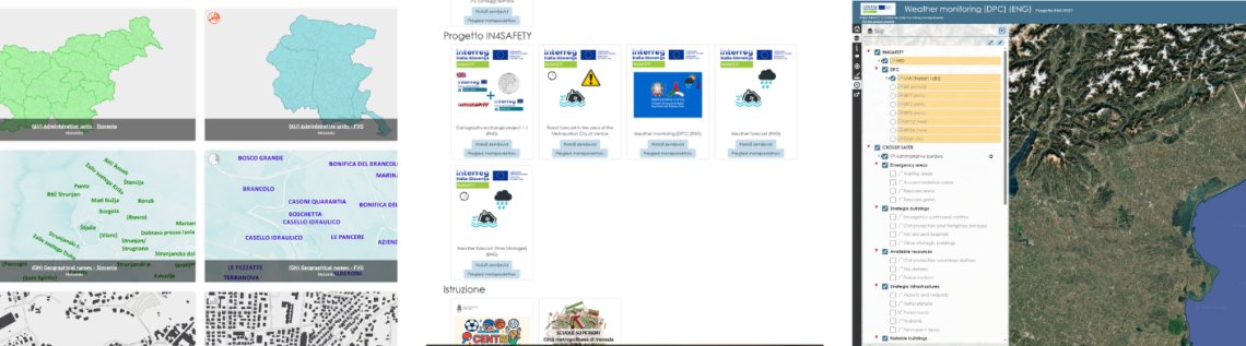
Within the framework of the project, the territorial databases and web GIS solutions CROSSIT SAFER and HARMO-DATA have been enhanced. The enhancement includes the expansion and updating of spatial data, their integration into a common web GIS environment, and the inclusion of data on infrastructure, buildings, protected areas, land use and other elements relevant to risk management and response to natural disasters.
An important new feature is the implementation of a system for rainfall monitoring and flood forecasting in the Municipality of Venice area. The system integrates meteorological data and rainfall forecasts with a digital twin of the area and a hydrological model, enabling the visualization of potentially flooded areas and potentially affected buildings. Automatic email alerts have also been introduced for forecasted heavy rainfall or potential flood events.
The HARMO-DATA geoportal has also been connected with IN4SAFETY and CROSSIT SAFER content and enriched with the visualization of specific natural disasters, such as the 2022 Karst fire and the 2023 floods in Slovenia.
The achievement represents an enhanced and integrated cross-border spatial data environment, enabling more effective risk monitoring, planning of measures and support for response activities in the event of natural disasters.
D 1.3.1 Workshops
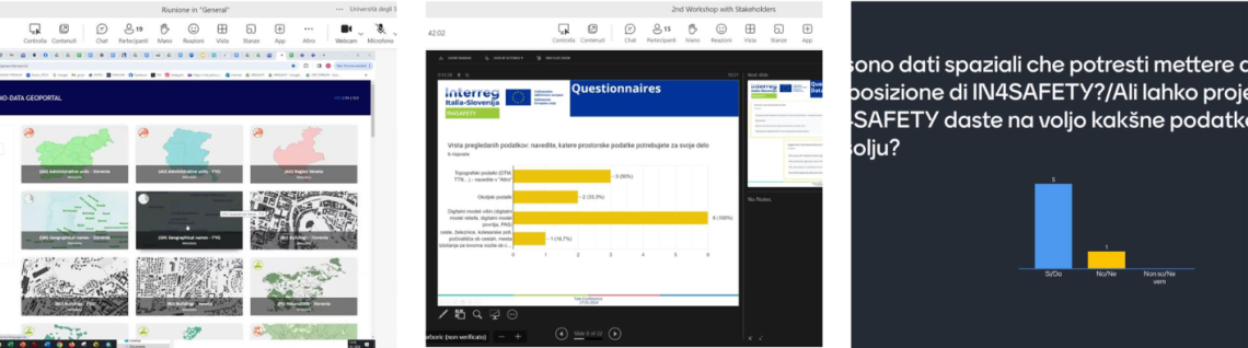
In March 2024, two cross-border online workshops were held for representatives of civil protection authorities, fire and rescue services, mountain rescue organisations, and other key stakeholders from Slovenia and Italy. The activity aimed to present the project's objectives, existing WEB GIS platforms, and cross-border digital datasets, contributing to the harmonisation and updating of spatial data to strengthen cross-border cooperation in natural disaster management.
The workshops included presentations, round-table discussions, and the collection of feedback through a bilingual questionnaire and interactive engagement tools. The results and recommendations gathered from stakeholders were used to improve subsequent project activities and provided a basis for more effective cross-border exchange of digital data among the participating organisations.
D 1.3.2 Final Conference
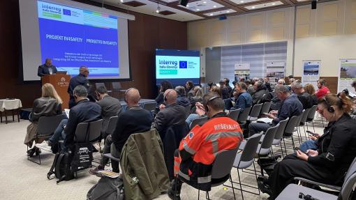
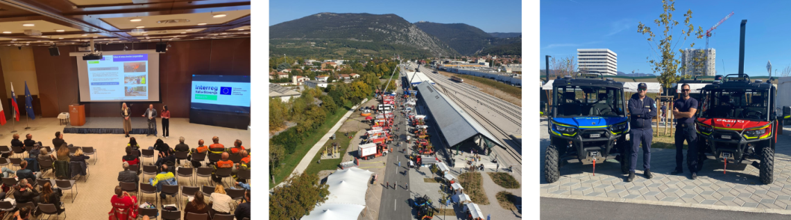
The IN4SAFETY Final Conference marked the closing event of several years of cross-border cooperation between Slovenian and Italian partners in the field of civil protection and emergency response. The conference presented the project's main achievements, implemented activities, and the experience gained in developing joint solutions to improve preparedness and response to natural and other emergencies. Particular emphasis was placed on the importance of cross-border cooperation, the exchange of expertise, and the strengthening of the operational capacities of the participating organisations.
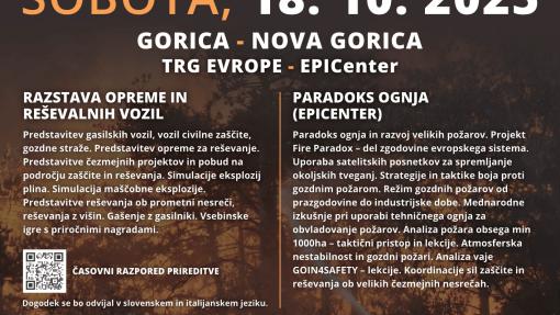
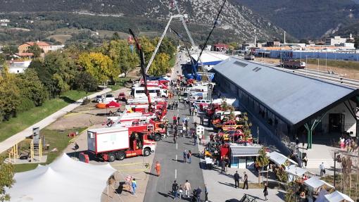
As part of the event, an exhibition of rescue vehicles and equipment was held at Europe Square (Piazza Transalpina/Trg Evrope), where fire brigades, civil protection units, and other emergency services from Slovenia and Italy showcased their capabilities. The exhibition gave visitors the opportunity to explore modern rescue vehicles, equipment, and technologies used in emergency operations, while highlighting the importance of cooperation, prevention, and the continuous development of response capacities for effective emergency management.
Video - Final conference and the exhibition of rescue vehicles and equipment
D 1.3.3 and D 2.4.1 Promotional material
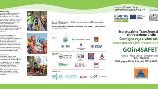
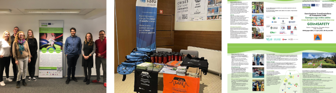
A project poster, roll-up banner and brochure containing information about the project and emergency response procedures were produced, with all materials prepared in accordance with the Programme communication guidelines and bearing the Programme logo. Additional promotional materials for the dissemination of the project were also prepared.
D 1.2.2 Training programmes
Within the framework of the IN4SAFETY project, a comprehensive training programme was developed and implemented to strengthen the professional competences of firefighters, civil protection personnel and other organisations involved in emergency response and rescue activities in the cross-border area between Slovenia and Italy. The programme combined theoretical lectures and practical workshops, enabling participants to enhance their knowledge of natural and other types of emergency management, inter-institutional cooperation, and the use of modern methods and technologies for more effective intervention operations. Particular attention was given to the exchange of experience among project partners and the development of common operational approaches, ensuring coordinated action on both sides of the border.
The training activities covered several thematic areas, including the use of geographic information systems (GIS) to support decision-making and intervention management, emergency response planning and coordination, and effective information exchange among relevant services. Through practical exercises, simulations and teamwork, participants gained new skills in using digital tools, improved their understanding of common procedures, and strengthened their ability to respond quickly and efficiently in cross-border emergency situations. The programme therefore made an important contribution to enhancing operational capacities, interoperability and long-term cooperation among the participating organisations.
D 1.2.2 Qualified professional staff
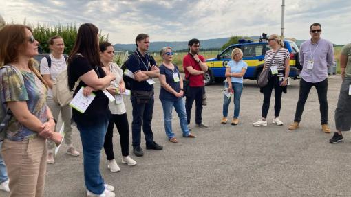
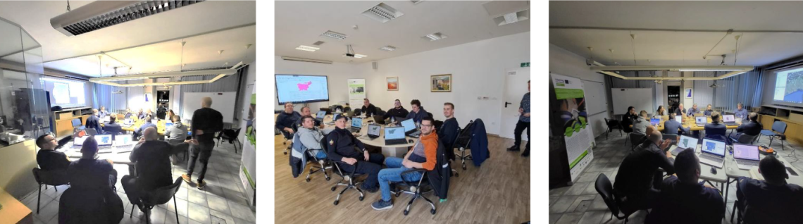
As part of the project, specialized GIS training sessions were conducted for representatives of fire departments, civil protection agencies, and other organizations within the protection and rescue system, with the aim of improving the use of geographic information systems in planning, decision-making, and managing emergency responses. Six training sessions with identical content were held at various locations; these combined theoretical lectures with hands-on work using GIS tools and helped strengthen participants’ professional competencies and cross-border cooperation.
The training program covered the use of digital cartographic data, the creation of thematic maps, the use of open-source GIS tools, and practical exercises based on specific operational scenarios. A total of 72 participants were trained, and the knowledge they gained contributed to the more effective use of spatial data in responding to natural and other disasters, as well as to the improvement of joint operational capabilities and cross-border information exchange.
D 2.3.1 Joint crossborder exercise
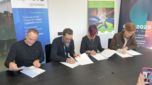
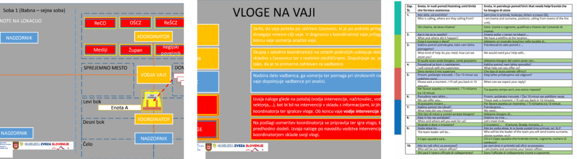
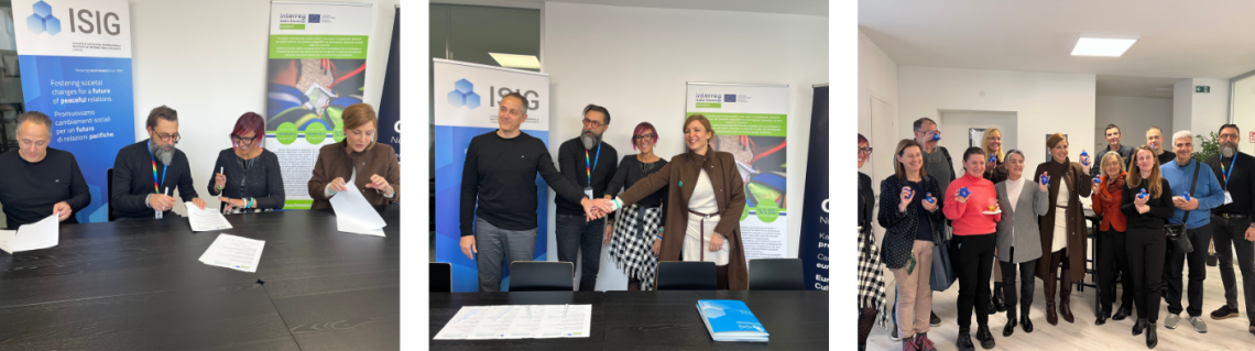
One of the key milestones of the IN4SAFETY project was the signing of the Memorandum of Understanding on 21 November 2024. The Memorandum was signed by representatives of the International Sociology Institute of Gorizia (ISIG), the Nova Gorica Fire Brigade (Gasilska enota Nova Gorica), GO! 2025, and the European Grouping of Territorial Cooperation GO (EGTC GO). By signing the Memorandum, the partners confirmed their joint commitment to preparing and implementing the cross-border civil protection exercise in the Gorizia–Nova Gorica area, while establishing a framework for coordinated planning and strengthening cooperation among organisations active in the field of civil protection.
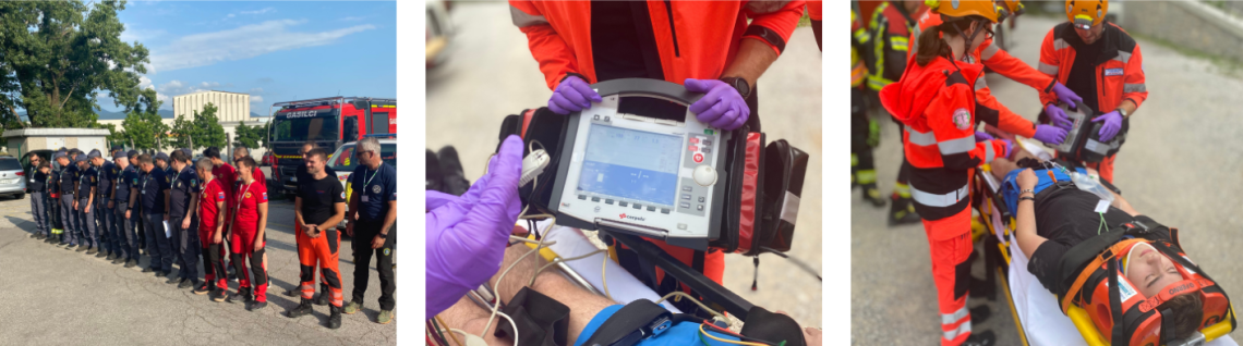
The GOin4SAFETY Joint Cross-Border Exercise was carried out from 5 to 8 June 2025 in the area of Gorizia, Nova Gorica, Šempeter-Vrtojba and the wider Gorizia area. The exercise was based on the simulation of a strong 5.1 magnitude earthquake and its consequences, with more than 20 different scenarios carried out in Slovenia and Italy. More than 500 civil protection operators, firefighters, police officers, volunteers, healthcare services and other organisations from Slovenia, Italy and other countries participated in the activity.
The main objective of the exercise was to test and improve preparedness, response capacity and coordination between the Slovenian and Italian civil protection and rescue systems. Participants tested their response to various emergency situations, including search and rescue operations, fires, accidents involving hazardous substances, cultural heritage protection, as well as crisis management and communication. The exercise also enabled the testing of joint protocols and the improvement of operational cooperation between institutions from both countries, thereby contributing to strengthening the resilience and safety of the cross-border area.
D 2.3.2 Simulation games
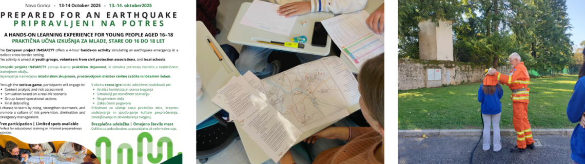
The simulation games (serious gaming) were aimed at secondary school students, with the objective of strengthening their knowledge of risks, particularly seismic risk in a cross-border context, and improving their understanding of decision-making processes in emergency management. The activity also promoted teamwork, critical thinking and the ability to deal with complex situations in simulated contexts. It was held on 13 and 14 October at the participating schools in Italy and at the Fire Brigade headquarters in Nova Gorica, in both Italian and Slovenian.
The programme was divided into three phases: an introductory phase presenting the IN4SAFETY project and providing a theoretical overview of seismic risk, an operational phase involving simulation activities in small groups, and a final phase presenting the results and discussing the outcomes. The activity involved a total of 122 students from Tolmezzo, Cividale del Friuli and Nova Gorica. The results showed a good level of participant engagement and contributed to a better understanding of seismic risk and emergency management.