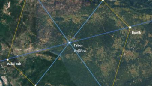
The geomantic analysis of the hillforts of Tabor (Vojščica), Grmača and Saint Ambrose, carried out within the framework of the Interreg VI-A Italy–Slovenia KAŠTellieri project, invites us to look at these protohistoric sites from a new perspective.
They are not merely defensive structures or archaeological remains, but key nodes within the Karst landscape: places selected over millennia not only for strategic reasons, but for their distinctive relationship with nature, natural resources, the morphology of the terrain and – according to geomantic interpretation – the energetic dynamics of space.
The study highlights how the three hillforts form an interconnected network:
Tabor as the central hub and point of convergence,
Grmača as a vital pole linked to water and the Karst underground,
Saint Ambrose as an ancient sacred site and spiritual landmark.
Why is this important?
Because this research helps us understand that heritage is not only a past to be preserved, but a living resource for the present. The hillforts can become spaces for education, responsible tourism, cultural enhancement and reflection on our relationship with the environment.
In an era marked by climate change and an increasing distance from nature, rediscovering the deep bond between communities and landscape means strengthening identity, belonging and responsibility towards the territory.
The Karst hillforts are not merely monuments: they are places that tell us who we once were – and who we may become.